
Technology
Paper maps aren’t dead, but this digital mapping app is an innovation for off-road explorers
Since the dawn of humanity, explorers and wanderers have sought to understand the world around us, navigating by the stars, landmarks and finally roads. The earliest maps were made in Babylon sometime around 600 BC as rough scratches on a clay tablet. The Greek scholar Ptolomy is often credited with the science of cartography, or the study and practice of map making.
Digital mapping company opX goes one step further by combining satellite images of maps with three-dimensional topographic lines and information about public and private land boundaries. This app provides disparate data for those most interested in hunting, fishing and off-roading, encourages safe exploration and helps prevent trespassing on clearly marked private lands.
“People who make maps are historians,” says Molly Stoecklein, senior communications manager at onX. “Maps tell a story, and it is a great responsibility to create these maps in a way that everyone can understand.”
This is how onX takes that to heart.
Are paper maps dead?
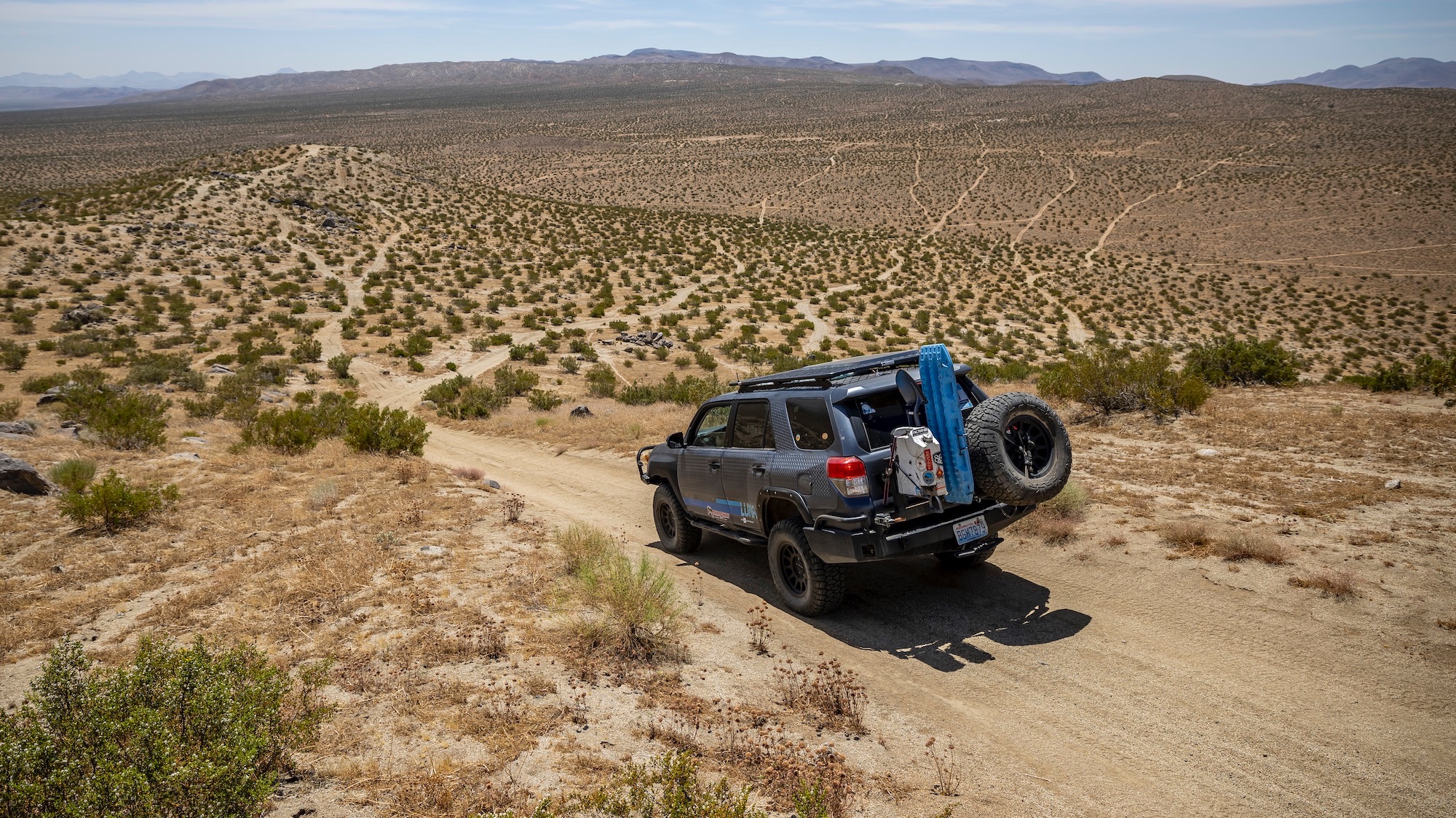
As a child, I would follow my finger along the route on my parents’ Rand McNally road map, trying to best understand where I was in this big, big world. Nowadays, most of us are used to working with Apple Maps, Waze and Google Maps, to name just a few navigation apps.
Unlike paper maps, modern, web-based maps can zoom in and out and rotate. OnX creates its own content and segments it into different tiles per zoom level. Then the cartography team decides what content to display and how to visualize it at each zoom level. For example, at a low zoom level you may see the outline of the state border, high-level topography (such as mountains, rivers, lakes), and hotspots for off-road activity. Zooming in reveals more detail as trails appear, as well as land ownership boundaries and points of interest for recreation. Mapbox is a third-party company that makes the underlying “map viewer” technology that onX uses to display those tiles and their design in 2D and 3D.
A map is only as good as the data underlying it, Stoeklein explains. Most navigation apps on the market use “off-the-shelf” data sources, she says, which are one-stop-shop sources like Open Street Maps (OSM). However, these apps do not change any information. Instead, onX contains thousands of other sources, such as local city Geographic Information System data, forest management data, and more.
“No data set is too small,” says Stoeklein. “We compare that data and choose the most accurate and up-to-date elements. For example, the data for a track in OSM may differ geospatially from that same track in the Forest Service data.”
OnX staff compares these different sources and uses human input through the quality control team to gather more information. They then choose the trail that most accurately represents what an app user would see on site.
“Some people see this app and say ‘printed maps are dead,’ and I say that’s not the case,” says April Leone, an engineer at onX and a frequent off-roader. “I think this is a good way to augment them with real-time information and input.”
Leone is a multiple participant in the Rebel rally, an eight-day, 2,500-mile off-road race for women. As we chased previous Mojave Desert rally checkpoints using onX routes for practice, the intersection of paper and digital data and how they complement each other became clear. During the rally itself, any device with GPS is strictly prohibited, but our practice runs using the onX app illuminated routes and approaches to high ground that I hadn’t thought of before.
Swiping down with two fingers turns the flat digital map into a three-dimensional view that helps to better understand the terrain. The paper topographic map translated the larger area. Together we had a panoramic view of the public lands.
The dichotomy of exploration and protection of natural resources
OnX makes it possible for adventurous people to explore far and wide, often further than before the app existed. There is some caution about the digitalization of mapping technology as environmentalists express concerns about wildlife and the fragile desert environment. Organic soil crust in Utah, for example, is a critical part of the ecosystem for plants and animals and cannot be easily replaced. Staying on established routes is critical to the survival of the terrain and to the sport of off-road.

The vast majority of avid off-roaders are aware of the guidelines of this trade organization and adhere to them Walk light!, a non-profit organization committed to ethics in this sector. The organization’s goal is to “balance the need for adventure of off-road and off-road vehicle users with the need to preserve the places they ride and explore.” In that spirit, hundreds of vetted onX trail guides complete TreadLightly! training before they are allowed to contribute.
Once in the system, contracted onX trail guides record their routes, take photos and write descriptions of the surface in comprehensive, easy-to-read text. The routes, represented in lines, points and shapes, are assessed and controlled by the company. Behind the scenes, onX’s cartography team has done all the background work to create an artistic rendering of the map in a way that makes sense to off-roaders.
“There is a lot of information on the map and we have to figure out how to make this simple,” says Stoecklein.
The app technically works around the world, Stoecklein says, explaining that some users have used the app in Iceland, Thailand and parts of South America and Africa. After all, the satellite images and GPS location are already built in. However, OnX’s base maps (topo, 3D, and higher resolution aerial photos) and content (trail data, etc.) are currently only available in North America, primarily the US. Canada and Baja.
So buckle up, choose a route and go explore.